|
Our Home is Where We Park It |

|
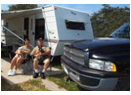
2005 was our first real year of full time RVing. The Texas Coastal Bend (Jan-Mar) was rest and recuperation. Larry had been trying to work while recovering from an auto accident. After some gains, he had plateaued, then became weaker. |
|
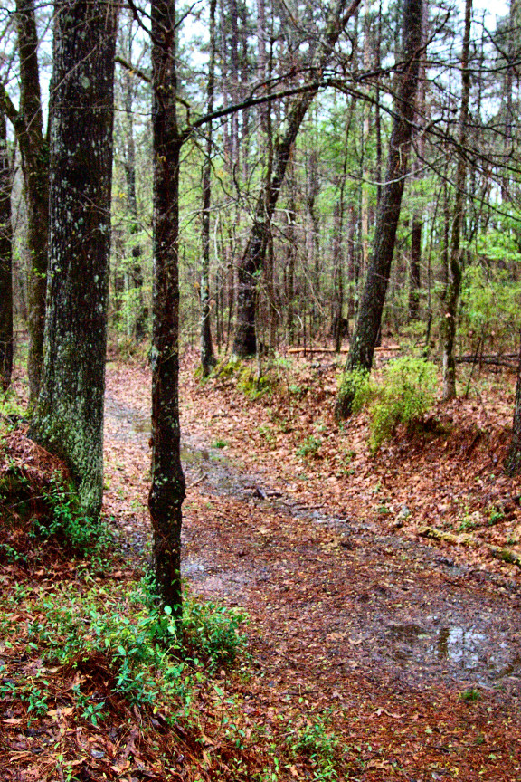
The Natchez Trace Parkway is a 400 mile long national park following the old Natchez Trace from Natchez LA to Nashville TN. There is no commercial traffic and a 55 MPH speed limit on the peaceful 2 lane road with many things to see and explore. Perfect for taking with an RV. Picture at left is a portion of the original trace walked by many early settlers of Tennessee and Kentucky when returning home after taking a flat boat to sell crops at New Orleans. We are sorry but there are no links to other pictures or web pages at this time. |
|
Natchez Trace |
|
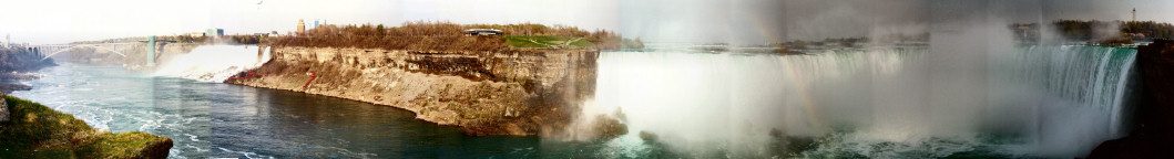
ABOVE: Niagara River is very peaceful a few miles up the river from the falls. There is a great walkway/bi keway path along the river. BELOW: A composite of many pictures to show both falls. These were stitched by a program that came with my printer. Sorry, no wedding pictures or other web pictures at this time. |
|
Niagara Falls Area |
|
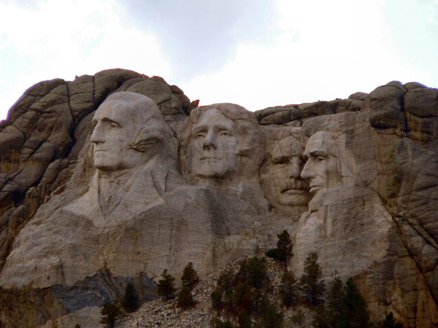
The Black Hills Area is one of our favorite places. At left is Mt. Rushmore from an unusual angle on Iron Mountain Road |
|
Across Wyoming. Sites between the Black Hills (SD) and Yellowstone (WY). At left are the Big Horn Mountains from the east. The Traveling Morgans went through the Powder River Pass as their first real test of their truck pulling their trailer. |

|
Across Wyoming |
|
Black Hills Area |
|
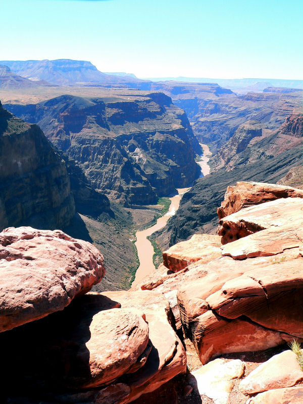
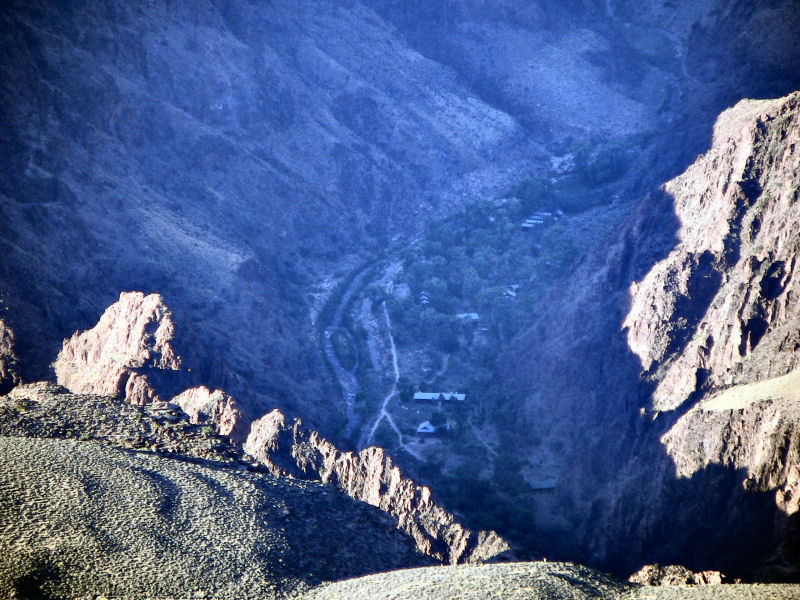
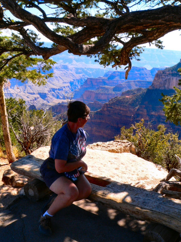
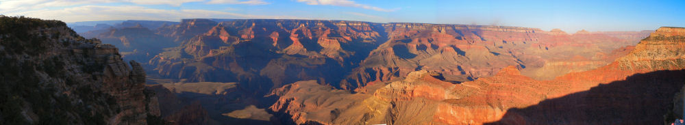
There are four main sections in the Grand Canyon National Park. The South Rim (above, — actually multiple pictures stitched together by AutoStitch) receives nearly 85 % of the tourists. Some places afford a view of the Colorado River, but most do not The North Rim (left) receives about 15 % of the visitors, and there is no view of the Colorado River at all. Less than 1% of the above the rim visitors see Torroweep (aka Tuweep). To go there requires a 50 mile drive on a gravel road. Then there is a 10 mile drive on the worst “road” we have ever seen. — we called it “Hells Highway” — to actually get to the canyon. You must have a high ground clearance vehicle. You can look 3000 feet straight down to the Colorado River. The North and South Rims have no such view. The Inner Canyon receives those who are in great shape for walking, or can qualify for a burro trip (under 200 lbs), or take a two week rafting trip. The more affluent may go by helicopter. The Traveling Morgans only experience the Inner Canyon by use of a telephoto lens or binoculars. |
|
Grand Canyon National Park |
|
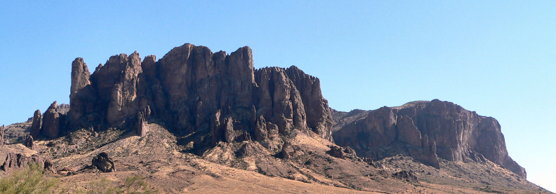
We stayed the winter of 2005-2006 near the foot of the famous Superstition Mountains at Apache Junction Arizona. |
|
Central Arizona — Superstition Mountains |
|
Click on any picture to see a larger version. |

|
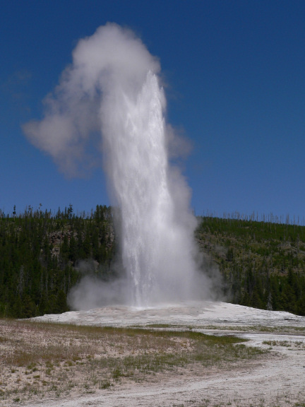
There are many ways to describe Yellowstone, and all of them will wear out anybody’s supply of superlatives. The wildlife, mountains, alpine environment, thermal features and river canyons are each worthy of a natural park on their own. They are all together in Yellowstone National Park. Click on the picture of Old Faithful and join The Traveling Morgans for our highlights of Yellowstone. |
|
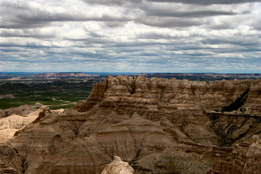
The Badlands of South Dakota are wonderfully strange. Sheep Mountain Table (left) is off the beaten path and gives you a chance to see things from another angle. You need high ground clearance to travel the top of the table, but most cars and trucks can make it to this section on the south rim. . |
|
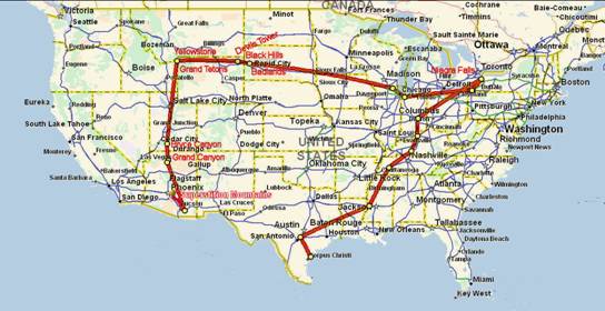
Our 2005 travels are outlined above. |
2005—Traveling Morgans—2005
Page Last Updated: April 10, 2008 |
Destinations and Travel Highlights
|
|
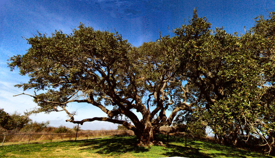
The Coastal Bend of Texas is the coast of the Gulf of Mexico where it changes from an east-west orientation to a north-south orientation in the general vicinity of Corpus Christi. The picture at left is The Great Tree of Lamar. |
|
Yellowstone National Park |
|
Texas Coastal Bend |