Iron Mountain Road
The stunning scenery of the Black Hills is the tremendous feature of Iron Mountain Road. Each of the three tunnels on the road has a view of Mt. Rushmore from one of the two directions. The Traveling Morgans recommend taking the trip from South (Custer State Park) to North (between the town of Keystone and Mt Rushmore). We have attempted to lay out this page in that manner. If you have the time, it will be worth your time to take the route from the other direction as well.
Iron Mountain Road was laid out carefully to not disturb the nature landscape. The result is a great scenic drive with with extraordinary overlooks, unique "pig tail" bridges, some one lane ribbons of road, and three one-car tunnels, each of which frames Mt. Rushmore. If someone is coming through the tunnel from the other direction, you must take turns.
This is not a drive to take while towing ANY trailer (due to tight turns) or a motorized RV larger than a true van-type class "B" -- not even a B-Plus. Tunnels are limiting -- 9 feet 7 inches high officially. Find a place to park an RV and go with your toad or tow vehicle.
Be sure your brakes are in good working order -- the person in front of you might stop very quickly to admire the beauty. This may be the best map to include Iron Mountain Road and its tunnels on the internet, and it only shows two tunnels.
South Unmarked Viewpoint
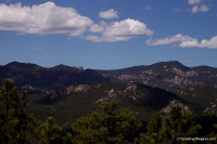
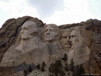
Near Custer State Park is a large National Forest sign. The sign describes the vegetation, but does not mention the fantastic view. If you use strong binoculars, you will see Harney Peak (the highest point east of the Rockies) and Mt Rushmore. The first picture below has both in the background. The second one zooms in closer to Mt Rushmore. You can see the monument in the context of the entire mountain.
South Tunnel
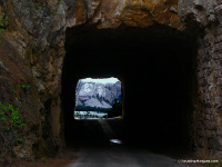
The south tunnel is the furthest from Mt Rushmore, but much closer than the south viewpoint noted above. If you are not watching, you could drive through and not notice Mt Rushmore. If you are going from Custer State Park toward Keystone and Mt Rushmore (the recommended direction), you will see the view of Mt. Rushmore through your windshield as you go through. Be watching. Also watch for the person in front of you to hit their brakes when they recognize the monument and watch for the person who took one of the few parking spaces to get a picture from inside the tunnel.
Road Views
Here are examples of the need for good brakes. The person ahead of you may stop quickly when one of these scenes come into view. These actually had a place to pull off. Other beautiful scenes have have no place to pull off the road.


